Berkas:North America second level political division 2.svg

Kontén kaca nénten kadukung ring basa liyanan.
Saking Wikipédia

Berkas sujati(Berkas SVG, jimbarnyané 512 × 596 piksel, agengnyané berkas: 132 KB)

Berkas puniki mawit saking Wikimedia Commons lan minab kaanggén antuk proyék-proyék sané lianan. Déskripsinnyané ring kaca déskripsi berkasnyané kaarahin ring sor puniki.

Ringkesan

Déskripsi
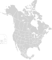
English: Map of North America and its second-level political divisions. Canadian provinces, US and Mexican states. Canada, Mexico, United States.

Non-contiguous parts of a states/provinces are "grouped" together with the main area of the state/provinces, so any state/provinces can be coloured in completion with one click anywhere on the state/provinces's area.

Also, all states/provinces have a "id" attached to them, making them easy to find. Select "find" and then enter in the state/provinces's ISO 3166-2 code in the "id" field to find it. The codes can be found here (Canada), here (USA) and here (Mexico).
Tanggal
Wit

Canada and US map: BlankMap-USA-states-Canada-provinces, HI closer.svg by Lokal_Profil.
Mexico map: Mexico template.svg by Mario Fuente Cid
Combined by Alex Covarrubias.

 
The SVG code is valid.
 
This vector image was created with Inkscape, and then manually edited
.
 
W3C-validity not checked.
Sang anyurat Alex Covarrubias
Lugra
(Nganggén malih berkas puniki)
w:id:Creative Commons
atribusi wagiang pateh
Berkas ini dilisensikan di bawah lisensi Creative Commons Atribusi-Berbagi Serupa 2.5 Generik
Ida kadadosang:
  • Ngedum – Nyadur miwah nyobyahang malih suratan puniki ring wentuk utawi format napi ja
  • Nyampuhang – Ngubah pakaryan puniki
Ring sor kawéntenan puniki:
  • atribusi – Ragané patut ngenahang krédit sané patut, ngicénin pranala lisénsinnyané, miwah nguningaang yéning ngardi uahan. Ragané prasida nglaksanaang nganggé tata cara sané sumakuta, nanging nénten mateges yéning sang ngicénin lisénsi nyokong ragané utawi panganggén ragané.
  • wagiang pateh – Yening ragane nyampuh, ngubah, utawi ngwangun ring ajeng pakaryan, Ida patuh nyobyahang kontribusi druene ring ungkur lisensi sane pateh utawi kompatibel manut sujatinyane
Versi lainnya

Derivative works of this file:

Sesirah

Add a one-line explanation of what this file represents

Items portrayed in this file

menggambarkan Indonesia

status hak cipta Indonesia

berhak cipta Indonesia

7 Oktober 2007

Babad berkas

Klik ring tanggal/galah anggén nyingakin berkas puniki ri tatkala galah punika.

Tanggal/GalahGambar alitDiménsiSang anganggéPanampen
mangkin23 Nopémber 2020 09.51Gambar alit indik vérsi 23 Nopémber 2020 09.51512 × 596 (132 KB)Ponderosapine210Added the prominent islands of Manitoulin (Ontario) and Isle Royale (Michigan) to the Great Lakes.
2 Juni 2019 07.07Gambar alit indik vérsi 2 Juni 2019 07.07512 × 596 (130 KB)Fluffy89502added territories, made DC visible, adjusted mexican borders
4 April 2014 20.23Gambar alit indik vérsi 4 April 2014 20.231.712 × 1.992 (270 KB)Lommesmade the borders between the mexican subdivisions the same size as their canadian / us counterparts.
9 Désémber 2007 07.23Gambar alit indik vérsi 9 Désémber 2007 07.231.712 × 1.992 (327 KB)Lokal ProfilCode cleanup
7 Oktober 2007 15.55Gambar alit indik vérsi 7 Oktober 2007 15.551.712 × 1.992 (342 KB)AlexCovarrubias== Summary == {{Information |Description=Map of North America and its second-level political divisions. Canadian provinces, US and Mexican states. Canada, Mexico, United States. |Source=Canada and US map by Alan Rockefeller. Mexico map by Alex Covarrubias

Nénten wénten kaca sané nganggén berkas puniki.

Panganggén berkas ring jagat

Métadata