
Berkas:NetherlandsNewGuinea-1916.jpg

Berkas sujati (3.000x1.895 piksel, agengnyané berkas: 6,3 MB, soroh MIME:image/jpeg)
Ringkesan

|
This image needs restoration.
If the old version is still useful, for example if restoring the image will alter the image significantly, upload the new version under a different title so that both can be used (e.g. [[File:Mount_Everest.jpg]] → [[File:Mount_Everest - restored.jpg]]. After uploading the restored version, replace this template with:
{{superseded|File:Mount Everest - restored.jpg|image restored}}, replacing the italicised name with the file name in question.
|
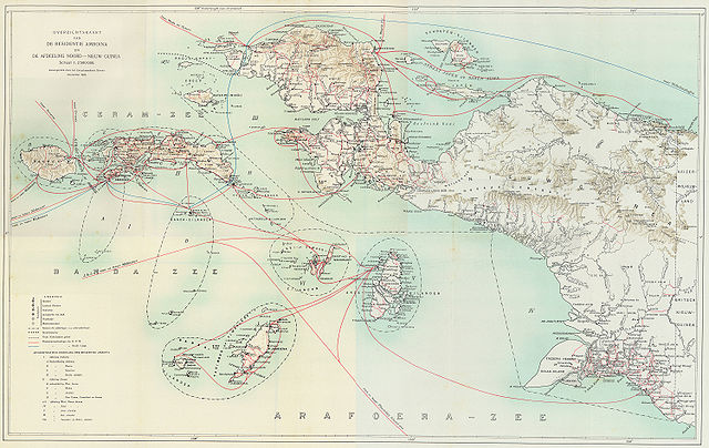
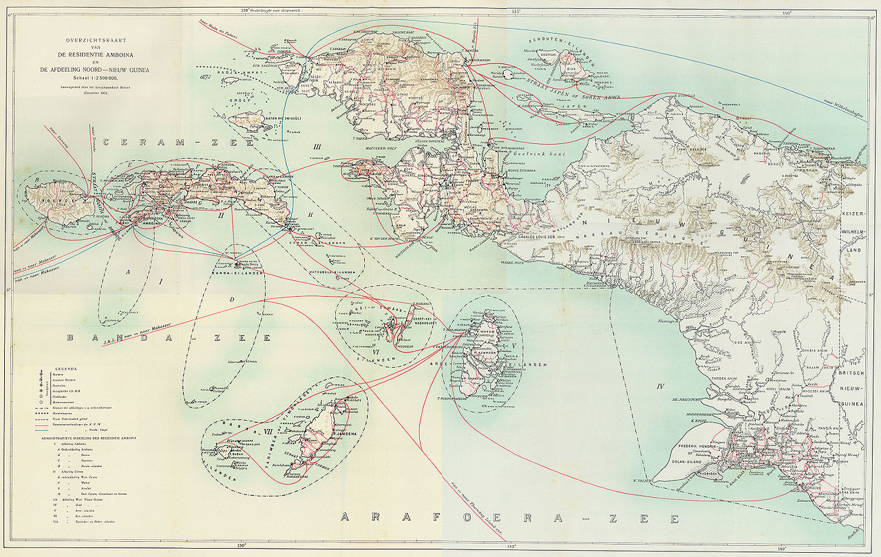
Steamboat connections in Netherlands New Guinea (1915)
This map, published in 1915, is an overview of steamboat connections in the Western New Guinea region. The image was published in Batavia (now Jakarta, Indonesia) in what was then known as the Dutch East Indies. The map is published by a company called G. Kolff & Co and uploaded by PapuaWeb.org archive copy at the Wayback Machine on the Maps of Papua archive copy at the Wayback Machine page. As per the Netherlands Copyright Act of 1912 archive copy at the Wayback Machine, which applies to works published in the Dutch East Indies (Article 47a), the copyright has expired on 1 January 1986 because only the publishing company, not the author, is known (Article 38).
From en:Image:NetherlandsNewGuinea-1916.jpg by en:User:Arsonal
Lisénsi
|
This work is in the public domain in its country of origin and other countries and areas where the copyright term is the author's life plus 70 years or fewer.
| |
| Berkas ini telah diidentifikasi bebas dari pembatasan menurut hukum hak cipta termasuk semua hak terkait dan relevan. | |
Babad berkas
Klik ring tanggal/galah anggén nyingakin berkas puniki ri tatkala galah punika.
| Tanggal/Galah | Gambar alit | Diménsi | Sang anganggé | Panampen | |
|---|---|---|---|---|---|
| mangkin | 7 Juli 2006 05.52 | | 3.000 × 1.895 (6,3 MB) | Hardscarf | == Summary == === Military Expeditions to Nederlands Nieuw-Guinea 1907-1915 === This map published in 1916 is a documentation of Dutch military expeditions to the Western New Guinea region. The image was published in Batavia (now Jakarta, Indonesia) in |
Panganggén berkas
Kaca nganggén berkas puniki:
Panganggén berkas ring jagat
Wiki lianan ring sor puniki nganggén berkas puniki:
- Panganggén ring ar.wikipedia.org
- Panganggén ring arz.wikipedia.org
- Panganggén ring ca.wikipedia.org
- Panganggén ring cs.wikipedia.org
- Panganggén ring de.wikipedia.org
- Panganggén ring en.wikipedia.org
- Panganggén ring eo.wikipedia.org
- Panganggén ring es.wikipedia.org
- Panganggén ring fr.wikipedia.org
- Panganggén ring id.wikipedia.org
- Panganggén ring it.wikipedia.org
- Panganggén ring ja.wikipedia.org
- Panganggén ring ko.wikipedia.org
- Panganggén ring nl.wikipedia.org
- Panganggén ring pam.wikipedia.org
- Panganggén ring pl.wikipedia.org
- Panganggén ring pt.wikipedia.org
- Panganggén ring ru.wikipedia.org
- Panganggén ring sq.wikipedia.org
- Panganggén ring sv.wikipedia.org
- Panganggén ring tr.wikipedia.org
- Panganggén ring www.wikidata.org
- Panganggén ring zea.wikipedia.org
- Panganggén ring zh.wikipedia.org