
Berkas:Austria relief location map.jpg

Agengnyané pratuduh puniki: 800 × 446 piksel. Résolusi lianan: 320 × 178 piksel | 640 × 357 piksel | 1.256 × 700 piksel.
Berkas sujati (1.256x700 piksel, agengnyané berkas: 677 KB, soroh MIME:image/jpeg)
Ringkesan
| Déskripsi |
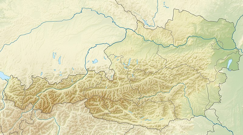
English: Location map of Austria
Equirectangular projection, N/S stretching 150 %. Geographic limits of the map:
|
| Tanggal | |
| Wit | Kriya ngraga |
| Sang anyurat | Uwe Dedering |
| Versi lainnya |
Derivative works of this file: ÖRF 2011.png
|

Lisénsi
Saya, pemilik hak cipta dari karya ini, dengan ini menerbitkan berkas ini di bawah ketentuan berikut:
Kaca puniki kalisensian olih lisensi Creative Commons Atribusi-Nyobyahang sané pateh 3.0 Nenten madué Adaptasi
- Ida kadadosang:
- Ngedum – Nyadur miwah nyobyahang malih suratan puniki ring wentuk utawi format napi ja
- Nyampuhang – Ngubah pakaryan puniki
- Ring sor kawéntenan puniki:
- atribusi – Ragané patut ngenahang krédit sané patut, ngicénin pranala lisénsinnyané, miwah nguningaang yéning ngardi uahan. Ragané prasida nglaksanaang nganggé tata cara sané sumakuta, nanging nénten mateges yéning sang ngicénin lisénsi nyokong ragané utawi panganggén ragané.
- wagiang pateh – Yening ragane nyampuh, ngubah, utawi ngwangun ring ajeng pakaryan, Ida patuh nyobyahang kontribusi druene ring ungkur lisensi sane pateh utawi kompatibel manut sujatinyane

|
Kapatutang yéning jagi nyadur, nyobyahang miwah/utawi ngaryanin vérsi lianan saking suratan puniki ring pungkur awig-awig Lisensi Pupulan Bebas GNU, Versi 1.2 utawi sané pinih anyar katerbitang olih Free Software Foundation; nénten madué Invarian, nèten madué téks sampul ring arep, miwah nénten madué téks sampul ring ungkul. Saduran lisensi asukan ka kepahan sané mamurda Lisensi Pupulan Bebas GNU. |
Ida dados milih lisénsi pilihan idané


Babad berkas
Klik ring tanggal/galah anggén nyingakin berkas puniki ri tatkala galah punika.
| Tanggal/Galah | Gambar alit | Diménsi | Sang anganggé | Panampen | |
|---|---|---|---|---|---|
| mangkin | 28 Juni 2010 17.14 | | 1.256 × 700 (677 KB) | Uwe Dedering | very little border change |
| 26 April 2010 20.24 |  | 1.256 × 700 (677 KB) | Uwe Dedering | rhine | |
| 24 April 2010 20.54 |  | 1.256 × 700 (676 KB) | Uwe Dedering | {{Information |Description={{en|1=Location map of Austria}} Equirectangular projection, N/S stretching 150 %. Geographic limits of the map: * N: 49.2° N * S: 46.3° N * W: 9.4° E * E: 17.2° E Made with Natural Earth. Free |
Panganggén berkas
2 kaca puniki nganggén berkas puniki:
Panganggén berkas ring jagat
Wiki lianan ring sor puniki nganggén berkas puniki:
- Panganggén ring ab.wikipedia.org
- Panganggén ring als.wikipedia.org
- Panganggén ring am.wikipedia.org
- Panganggén ring an.wikipedia.org
- Panganggén ring ar.wikipedia.org
- Panganggén ring arz.wikipedia.org
- Panganggén ring ast.wikipedia.org
- Panganggén ring as.wikipedia.org
- Panganggén ring azb.wikipedia.org
- Panganggén ring az.wikipedia.org
- Panganggén ring ba.wikipedia.org
- Panganggén ring be-tarask.wikipedia.org
- Panganggén ring be.wikipedia.org
- Panganggén ring bh.wikipedia.org
- Panganggén ring bn.wikipedia.org
Cingak panganggén sajagaté sané lianan saking berkas puniki.